The French electorate has spoken, even as it has neglected to finish the conversation. Round one of the country’s double-staged presidential vote has left two candidates – Emmanuel Macron and Marine Le Pen – standing, and stage two’s denouement, calendered for May 7, will halve the count.
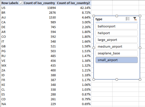
While several media have plotted enlightening cartographic breakouts of the votes, e.g. the New York Times, Bloomberg, and the Guardian – my query about spreadsheet-available data for the election was answered in part by the www.opendataparis.fr site, whose team kindly pointed me to a workbook detailing the vote in Paris, at least. I’m pointing it to you here:
Presidential Results 2017 Paris
And detailed it is, perhaps to a fault. After you’ve clicked past the necessary column auto-fits you’ll probably determine that the relentlessly identical election date reference in column B can be ignored or deleted, for example, along with no-less-invariant “Présidentielle 2017 – 1er tour” legend in A (note: the data here were extracted from a far larger vote compendium archiving many elections, in which the data in A and B are importantly differentiating). It seems in addition that the Numéro de la circonscription field in E is blank, save its header, though again this field is populated with other election data in the larger workbook parenthesized above. Moreover, I can’t see the clarificatory virtues of the fields in F and G; they seem to merely re-present Paris’ arrondissement (district) numbers in elaborations that restate the plainer entries in the numero d’arrondissement 01 a 20 field in C. If I’m missing something, I’m in the book.
Of course even if you do avail yourself of the arrondissement data in F don’t fret about all those Number Stored as Text messages signaled by the pesky green rectangles; you’re not going to add or subtract arrondissments. But you may have a right, however, to be bothered by the text-number conflation in some other fields, namely O and P, which appear to record blank and otherwise voided ballots, if my French can be relied on. For those, you can select the columns (even simultaneously) and tick the Convert to Number option draped immediately beneath Number Stored as Text.
Once we’re provisionally happy with the data as we’ve reconstructed them, we can ask the preeminent question: how did each candidate do in Paris? This pivot table should conduce toward an answer:
Rows: nom du candidat ou liste
Values: nombre de voix du candidat ou liste….
Apply it again, % of Column Total
You may want to rename those stupendous Values titles, Anglicizing them perhaps to Number of Votes and Percent of All Votes.
I get:

What shouts its headline at us, of course, is Paris’ extraordinary inattention to the candidacy of Marine Le Pen. The national runner-up shambled into a barely-perceptible fifth place in the city, outvoted seven-fold by Emmanuel Macron, whose 321,000 margin over Le Pen in Paris contributed one-third of his country-wide superiority (for the national numbers see this recapitulation).
But the data also support a closer look at the numbers, a look worth taking. We can, after all, size up the vote by Paris’ 20 arrondissements. :
Row Labels: nom du candidat ou liste
Columns: numero d’arrondissement 01 a 20
Values: Percent of all votes (by % of Column Total; remove Grand Totals, as they all add to 100%)
I get:

The fact of inter-district variation is instructive and unsurprising, but in need of interpretation just the same. Note, for example, the domination of the posh 16th arrondissement by center-right aspirant François Fillon, and his fallback to 12.78% in the far more proletarian 20th, the latter (and neighboring 19th) captured in turn by the “hard-left’s” Jean-Luc Mélenchon, who at same time came away with but 5.40% in the 16th. Le Pen maxes out at 6.48% in the Left Bank’s 13th, but her weakest showing plays our in the not-far-away 6th, also on the Rive Gauche.
The vote considerations could also be scaled to the very different arrondissement sizes and turnouts, e.g.
Rows: numero d’arrondissement 01 a 20
Values: Percent of All Votes (here a simple Sum; yes, the heading could stand a rewrite. You may or may not want to keep the Grand Totals off-screen here).
I get:

Note the rough association between arrondissement number and vote totals, remembering that arrondissements spiral outwards and clockwise, with the 1st and 2nd mapped in Paris’ center.
And in view of all the intra-arrondissement, politico-demographic variation, a comparison of arrondissement turnout rates might be correspondingly informative; but that remit comes with a challenge – this one of spreadsheet, not political provenance. That challenge owes to the way in which the vote records are organized, because in addition to its candidate-respective total every record names the pertinent arrondissement, a polling-place id – numero de bureau de vote 000 a 999 – as well as the number of registrants enrolled at that place – nombre d’inscrits du bureau de vote (and yes, you’ll have to convert those data into numbers, too).
The problem, then, is to stem the repeated counting of the registrant total alongside the individual candidate votes per record. If, for example, ten candidates have won votes at a given ballot place, the registrant sum for that place will appear ten times in the data set, even as we want it to appear but once. Comprendez?
Here’s what I think qualifies as workaround. First, I ranged-named the arrondissement numbers in C arr, and the ballot-place ids in D bur. I next jumped into next-free-column R, named it Registrants, and entered, in R2:
=H2/COUNTIFS(arr,C2,bur,D2)
What’s this formula doing? It’s grabbing the registrant total for each record in H (once you copy the formula down that column) and in effect dividing it by the number of ballot places (bureaus) in the arrondissement, a count realized by the COUNTIFS. Thus, for example, if a given record reports 1300 registrants in a ballot place in which ten candidates competed, the formula divides 1300 by 10 in each record. Add these ten, and we’re back to the 1300 registrants – but appearing only once.
If we then proceed to this pivot-table:
Rows: numero d’arrondissement 01 a 20
Values: Registrants
Sum of Number of Votes

The registrants totals should properly sum all the unique voters enrolled in each arrondissement, as per the explanation above.
I next devised a calculated field, which I called arrtotal:


Thrown into the pivot table, and percentage-formatted accordingly, I got:

The turnout proportions are impressively similar but not perfectly equivalent, ranging from the high of 86.63% in the tony 7th to the low of 77.49% in the 19th. There are surely correlations in there to be studied, but either way, the percentages far transcend the rates for US presidential contests.
Any thoughts about that, Monsieur Trump?